The route is suitable for people of different age and physical condition. The exception is people for whom excessive physical strain and long walks with night-over in tents are not recommended for medical reasons.
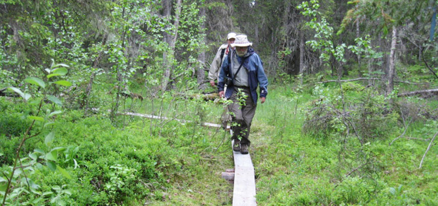
The trail is well-maintained with information placards, wooden duckboards across waterlogged spots, campfire sites, a shed with firewood.

The trail begins at the motor road 2.5 km before the south border of the National Park and the rangers station on Nuris river. First the trail runs to the west along the old clearing, then by an old horse track. Wooden boards make easier the passage over waterlogged depressions. Light bridges were made across small streams.
In the old times the farmers used this horse trail to transport to Finland in winter herring from the White Sea, peddlers brought their merchandise to Karelia, Finnish merchants came to local fairs.
The trail runs by the edge of an old-age spruce forest around small mires. The area is a habitat of many lichens, some of them are entered in the Red Books of European countries: Usnea longissima and Lobaria pulmonaria. The presence of Usnea is an indicator of pristine forest. This lichen is extremely vulnerable to negative ecological changes. It is also possible to find here another rare lichen –Tholurna dissimilis, which is not found in Finland.
Further on the trail crosses the former state border. Before 1940 this territory belonged to Finland. The trail passes across a meadow covered with rich grass vegetation – it was the territory of an abandoned Finnish farmstead.
Then the trail runs between two lakes, one of them is called Pieni-Sikajarvi. There is a camping site on its shore where one can have a short rest or put up a tent, make fire using the wood from a shed.
Going around lake Pieni-Sikajarvi the trail crosses the Park’s border. After passing a small mire by duckboards one starts to ascend the mountain. Nuorunen fell (577 m) is the highest peak not only in Karelia. Geologists say that at this latitude from the Urals to the Gulf of Bothnia there is no mountain higher. The trail traverses the south-eastern slope. During the ascent one can witness three vertical successions of vegetation from taiga to forest-tundra and to tundra zone. There are small hanging mires on the fell slopes. A small lake fills one of the fissures in the rock.
The sacred seita stones of the ancient Sami tribes can be encountered on the hill. They are rather large rocks put on smaller boulders – ‘legs’. The Sami believed that the souls of demised shamans lived in these stones and strongly influenced the living. These worshiping sites are valuable historical monuments. One of the larger seita stones was found on Nuorunen mountain.
A splendid vista opens up from the summit of the mountain over lake Tavajarvi, Kivakka fell, Ukotunturi and other landmarks. Ruka mountain can be seen on the Finnish side on a cloudless day.